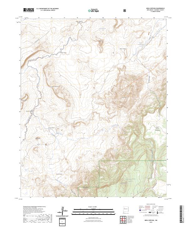
2023 Map of Mesa Cortada
USGS Topo · Published 2023About this map
Cibola National Forest encompasses the southeastern portion of this McKinley County landscape, where the Continental Divide National Scenic Trail winds through high-altitude terrain. The geography is defined by a series of prominent mesas and volcanic features, including Mesa Cortada, Mesa Crotalo, and the geological focal point of San Miguel Creek Dome. The drainage pattern is complex, with seasonal watercourses like Arroyo Chico and Arroyo Sarcio carving through the arid soil. Family names are etched into the land at Arroyo Alfredo Padilla, Cerro Chavez, and Rincon Chavez, suggesting a legacy of ranching and land use in this part of New Mexico. Sparse water sources such as Ojo Navajó, Ojo de los Indios, and Gonzolas Tank provide critical reference points in an area dominated by expansive land grants and township boundaries.
Find a feature on this map
32 named features on this map. Tap any name to fly to it.
Don’t see what you’re looking for? This feature index may not catch every label — zoom into the map to look around manually.
Map Details
Editions of this 2023 Mesa Cortada Map
This is the sole edition of this map. No revisions or reprints were ever made.
Other maps of this area

1883 · Mt. Taylor
USGS Topo · 1:250,000

1886 · Mt. Taylor
USGS Topo · 1:250,000

1892 · Mt. Taylor
USGS Topo · 1:250,000

1899 · Mt. Taylor
USGS Topo · 1:250,000

1958 · Albuquerque
USGS Topo · 1:250,000

1961 · El Dado
USGS Topo · 1:24,000

1961 · Cerro Parido
USGS Topo · 1:24,000

1961 · El Dado Mesa
USGS Topo · 1:24,000

1961 · Mesita Del Gavilan
USGS Topo · 1:24,000
1961 · Mesita Americana
USGS Topo · 1:24,000