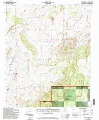
1995 Map of Mesa Cortada
USGS Topo · Published 1998About this map
Large Spanish land grants define the administrative history of this McKinley County landscape, where the Ignacio Chavez Grant and Felipe Tafoya Grant cover significant acreage. The terrain is marked by dramatic geological formations like the Battleship and Mesa Cortada, while the Cibola National Forest encompasses the southern highlands, including Cerro Colorado. Local ranching roots are evident at the Rancho de la Punta (Site) and the Michael Ranch, settlements that relied on scarce water sources such as Ojo Navaho and the Chico Arroyo. Throughout the region, various Oil Wells indicate the intersections of extraction and agriculture in the late twentieth century, set against the backdrop of the San Miguel Creek Dome.
Find a feature on this map
32 named features on this map. Tap any name to fly to it.
Don’t see what you’re looking for? This feature index may not catch every label — zoom into the map to look around manually.
Map Details
Editions of this 1995 Mesa Cortada Map
This is the sole edition of this map. No revisions or reprints were ever made.
Other maps of this area

1883 · Mt. Taylor
USGS Topo · 1:250,000

1886 · Mt. Taylor
USGS Topo · 1:250,000

1892 · Mt. Taylor
USGS Topo · 1:250,000

1899 · Mt. Taylor
USGS Topo · 1:250,000

1958 · Albuquerque
USGS Topo · 1:250,000

1961 · El Dado
USGS Topo · 1:24,000

1961 · Cerro Parido
USGS Topo · 1:24,000

1961 · El Dado Mesa
USGS Topo · 1:24,000

1961 · Mesita Del Gavilan
USGS Topo · 1:24,000
1961 · Mesita Americana
USGS Topo · 1:24,000