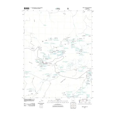
2011 Map of Mesa Lakes
USGS Topo · Published 2011About this map
Grand Mesa dominates this 2011 survey, showing a landscape defined by an intricate network of water management and seasonal camps. The terrain is a complex system of reservoirs and dams, including the Long Slough Reservoir, Crum Reservoir, and Big Beaver Reservoir. Human presence on this high plateau is represented by clusters of activity like the Mesa Lakes Resort and the Grand Mesa Lodge, alongside more utilitarian sites such as the Hallenbeck Cow Camp and Bull Creek Cow Camp. This mapping shows the intersection of livestock ranching and modern recreation, where the Kiwanis Youth Camp and several campgrounds like Glacier Spring Campground sit adjacent to working water infrastructure and the historical Beaver Homestead. The presence of the Crag Crest Trail Parking and the Land O Lakes Overlook highlights the area's role as a major destination for early 21st-century outdoor navigation.
Find a feature on this map
120 named features on this map. Tap any name to fly to it.
Don’t see what you’re looking for? This feature index may not catch every label — zoom into the map to look around manually.
Map Details
Editions of this 2011 Mesa Lakes Map
This is the sole edition of this map. No revisions or reprints were ever made.
Other maps of this area

1955 · Collbran
USGS Topo · 1:24,000

1955 · Mesa
USGS Topo · 1:24,000

1955 · Grand Mesa
USGS Topo · 1:24,000

1955 · Molina
USGS Topo · 1:24,000

1955 · Skyway
USGS Topo · 1:24,000

1956 · Montrose
USGS Topo · 1:250,000

1956 · Moab
USGS Topo · 1:250,000

1956 · Grand Junction
USGS Topo · 1:250,000

1957 · Leadville
USGS Topo · 1:250,000

1959 · Grand Junction
USGS Topo · 1:250,000