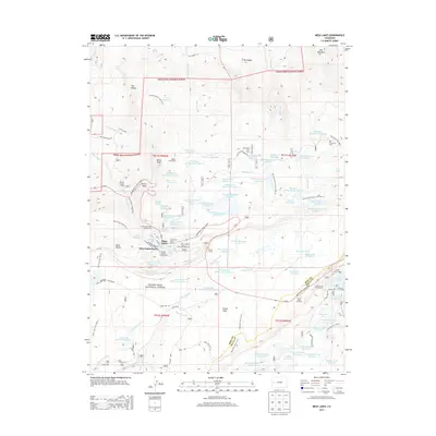
2013 Map of Mesa Lakes
USGS Topo · Published 2013About this map
Grand Mesa National Forest dominates this high-altitude landscape, characterized by an intricate network of reservoirs and alpine lakes. The area serves as a significant recreational and agricultural water resource, evidenced by the dense cluster of named bodies such as Coon Cr Reservoir Number 1, Bull Cr Reservoir Number 5, and the Lake of the Woods. The terrain rises toward landmarks like Spruce Point and the White Slide, overlooking the West Bench. Human activity is centered around the Mesa Lakes Resort and several specialized camps, including the Kiwanis Youth Camp and Hallenbeck Cow Camp. The presence of the Beaser Homestead provides a glimpse into early high-country settlement, while the Grand Mesa Scenic Byway and various pack trails like the Bull Basin Trail 2507.0 illustrate the historical and modern access routes through this complex geography.
Find a feature on this map
105 named features on this map. Tap any name to fly to it.
Don’t see what you’re looking for? This feature index may not catch every label — zoom into the map to look around manually.
Map Details
Editions of this 2013 Mesa Lakes Map
This is the sole edition of this map. No revisions or reprints were ever made.
Other maps of this area

1955 · Collbran
USGS Topo · 1:24,000

1955 · Mesa
USGS Topo · 1:24,000

1955 · Grand Mesa
USGS Topo · 1:24,000

1955 · Molina
USGS Topo · 1:24,000

1955 · Skyway
USGS Topo · 1:24,000

1956 · Montrose
USGS Topo · 1:250,000

1956 · Moab
USGS Topo · 1:250,000

1956 · Grand Junction
USGS Topo · 1:250,000

1957 · Leadville
USGS Topo · 1:250,000

1959 · Grand Junction
USGS Topo · 1:250,000