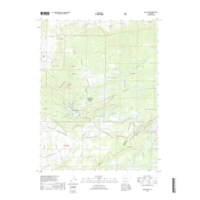
2019 Map of Mesa Lakes
USGS Topo · Published 2019About this map
Mesa Lakes sits at the heart of this high-elevation plateau within the Grand Mesa National Forest, where a complex network of reservoirs and irrigation infrastructure defines the landscape. The map details an extensive system of water management, ranging from the Crum Reservoir in the north to the Big Beaver Reservoir and various numbered Bull Basin and Coon Creek impoundments. This 2019 survey documents the region's primary role as a recreational and water-storage hub, marked by a dense web of winter trails such as the Lands End Loop Snowmobile and Skyway Ski Summit.
Find a feature on this map
97 named features on this map. Tap any name to fly to it.
Don’t see what you’re looking for? This feature index may not catch every label — zoom into the map to look around manually.
Map Details
Editions of this 2019 Mesa Lakes Map
This is the sole edition of this map. No revisions or reprints were ever made.
Other maps of this area

1955 · Collbran
USGS Topo · 1:24,000

1955 · Mesa
USGS Topo · 1:24,000

1955 · Grand Mesa
USGS Topo · 1:24,000

1955 · Molina
USGS Topo · 1:24,000

1955 · Skyway
USGS Topo · 1:24,000

1956 · Montrose
USGS Topo · 1:250,000

1956 · Moab
USGS Topo · 1:250,000

1956 · Grand Junction
USGS Topo · 1:250,000

1957 · Leadville
USGS Topo · 1:250,000

1959 · Grand Junction
USGS Topo · 1:250,000