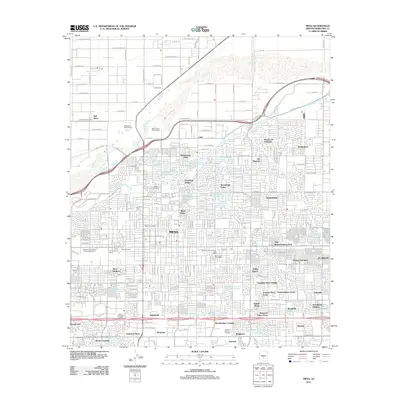
2011 Map of Mesa
USGS Topo · Published 2011About this map
Mesa's urban grid and residential expansion dominate the landscape in the early 21st century, revealing a complex network of subdivisions and water management. The northern reaches are defined by the Salt River and the Southern Canal, where older agricultural footprints like the University of Arizona Experimental Farm persist alongside newer developments. Communities such as Lehi, Marysville, and Hohokam Village illustrate the area's diverse settlement history, while aviation landmarks including J S J Airport and Ross Airport highlight the region's infrastructure.
Find a feature on this map
200 named features on this map. Tap any name to fly to it.
Don’t see what you’re looking for? This feature index may not catch every label — zoom into the map to look around manually.
Map Details
Editions of this 2011 Mesa Map
This is the sole edition of this map. No revisions or reprints were ever made.
Other maps of this area

1904 · Camelback
USGS Topo · 1:62,500

1904 · Desert Well
USGS Topo · 1:62,500

1904 · Ft. McDowell
USGS Topo · 1:62,500

1906 · Camelsback
USGS Topo · 1:62,500

1906 · Ft. McDowell
USGS Topo · 1:62,500

1906 · Desert Well
USGS Topo · 1:62,500

1913 · Mesa
USGS Topo · 1:62,500

1915 · Mesa
USGS Topo · 1:62,500

1930 · Cave Creek
USGS Topo · 1:125,000

1939 · Cave Creek
USGS Topo · 1:125,000