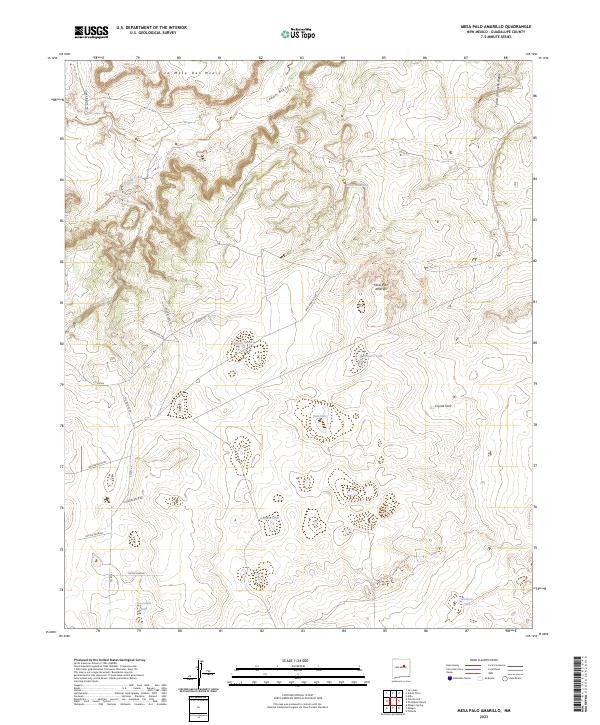
2023 Map of Mesa Palo Amarillo
USGS Topo · Published 2023About this map
Mesa Palo Amarillo rises above a landscape defined by ranching infrastructure and intermittent water sources in this Guadalupe County survey. The terrain is marked by deep drainage systems like Cañon Blanco and Cañon de Rancho Alegre in the north, while the southern reaches are dotted with livestock watering tanks such as Secundino Tank and Streetcar Tank. This network of tanks and small basins like Red Lake and Laguna Quates underscores the vital importance of water management in this arid high-desert environment. Local access is facilitated by a web of rural routes including Palo Amarillo Rd and Los Novios Rd, which navigate the tablelands and creek beds. The drainage of Potrillo Creek cuts through the western portion of the quadrangle, illustrating the natural erosion patterns that have shaped the mesa's surroundings.
Find a feature on this map
26 named features on this map. Tap any name to fly to it.
Don’t see what you’re looking for? This feature index may not catch every label — zoom into the map to look around manually.
Map Details
Editions of this 2023 Mesa Palo Amarillo Map
This is the sole edition of this map. No revisions or reprints were ever made.
Other maps of this area

1890 · Bernal
USGS Topo · 1:125,000

1891 · Bernal
USGS Topo · 1:125,000

1894 · Bernal
USGS Topo · 1:125,000

1954 · Santa Fe
USGS Topo · 1:250,000

1954 · Fort Sumner
USGS Topo · 1:250,000

1958 · Fort Sumner
USGS Topo · 1:250,000

1958 · Santa Fe
USGS Topo · 1:250,000
1963 · Thompson Ranch
USGS Topo · 1:24,000
1963 · Anton Chico
USGS Topo · 1:24,000
1963 · Mesa Palo Amarillo
USGS Topo · 1:24,000