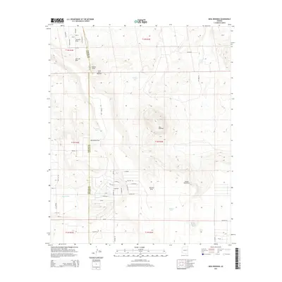
2014 Map of Mesa Redonda
USGS Topo · Published 2014About this map
Mesa Redonda and its smaller counterpart, Little Mesa Redonda, dominate this portion of the high desert landscape along the border of Navajo and Apache Counties. The terrain is defined by a series of drainage systems, or draws, that carve through the arid plateau, including Sandoval Draw in the north and the expansive Hay Hollow Draw further south.
Find a feature on this map
55 named features on this map. Tap any name to fly to it.
Don’t see what you’re looking for? This feature index may not catch every label — zoom into the map to look around manually.
Map Details
Editions of this 2014 Mesa Redonda Map
This is the sole edition of this map. No revisions or reprints were ever made.
Other maps of this area

1886 · St Johns
USGS Topo · 1:250,000

1892 · St Johns
USGS Topo · 1:250,000

1954 · Saint Johns
USGS Topo · 1:250,000

1955 · Adamana 4 SW
USGS Topo · 1:24,000

1955 · Adamana 3 SE
USGS Topo · 1:24,000

1955 · Hunt
USGS Topo · 1:62,500

1957 · Saint Johns
USGS Topo · 1:250,000

1958 · Saint Johns
USGS Topo · 1:250,000

1962 · Saint Johns
USGS Topo · 1:250,000
1971 · Vernon
USGS Topo · 1:24,000