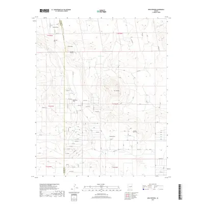
2018 Map of Mesa Redonda
USGS Topo · Published 2018About this map
Mesa Redonda rises as a prominent landmark in this section of the high desert, where the border of Navajo County and Apache County divides a landscape of complex drainage systems and isolated watering points. The terrain is defined by numerous draws, including Sandoval Draw and Cheney Draw, which funnel seasonal runoff across the arid plains toward Millet Swale. This network of natural irrigation is supplemented by man-made infrastructure like Martinez Tank, Red Rock Tank, and Baldwin Tank, indicating the area's continued reliance on managed water sources for ranching or local use.
Find a feature on this map
102 named features on this map. Tap any name to fly to it.
Don’t see what you’re looking for? This feature index may not catch every label — zoom into the map to look around manually.
Map Details
Editions of this 2018 Mesa Redonda Map
This is the sole edition of this map. No revisions or reprints were ever made.
Other maps of this area

1886 · St Johns
USGS Topo · 1:250,000

1892 · St Johns
USGS Topo · 1:250,000

1954 · Saint Johns
USGS Topo · 1:250,000

1955 · Adamana 4 SW
USGS Topo · 1:24,000

1955 · Adamana 3 SE
USGS Topo · 1:24,000

1955 · Hunt
USGS Topo · 1:62,500

1957 · Saint Johns
USGS Topo · 1:250,000

1958 · Saint Johns
USGS Topo · 1:250,000

1962 · Saint Johns
USGS Topo · 1:250,000
1971 · Vernon
USGS Topo · 1:24,000