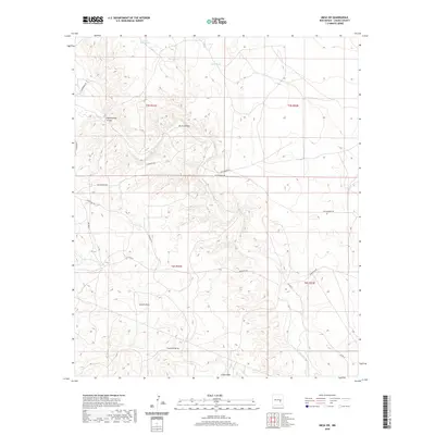
2020 Map of Mesa SW
USGS Topo · Published 2020About this map
Arroyo del Macho and its numerous tributaries dominate the drainage patterns of this Chaves County landscape, where deep erosional features define the high desert terrain. The map details a sophisticated network of ephemeral water management systems essential for land use in this arid region, including Burts Tank, Little Burts Tank, and Wells Tank. These named tanks and catchments suggest a history of ranching and livestock management across the various townships. Significant geological depressions and drainages such as Burts Canyon, Roach Draw, and Fourmile Draw slice through the landscape, illustrating the impact of seasonal runoff on the local topography. This 2020 survey captures a modern grid of rural roads, including Silverweed Rd and Chickweed Rd, that provide access to these isolated draws and catchments.
Find a feature on this map
19 named features on this map. Tap any name to fly to it.
Don’t see what you’re looking for? This feature index may not catch every label — zoom into the map to look around manually.
Map Details
Editions of this 2020 Mesa SW Map
This is the sole edition of this map. No revisions or reprints were ever made.
Other maps of this area

1955 · Roswell
USGS Topo · 1:250,000

1958 · Roswell
USGS Topo · 1:250,000

1962 · Roswell
USGS Topo · 1:250,000

1962 · Rock House Canyon
USGS Topo · 1:24,000

1962 · Marley Draw
USGS Topo · 1:24,000

1967 · Round Mountain SE
USGS Topo · 1:24,000

1967 · Round Mountain
USGS Topo · 1:24,000

1967 · Dunlap Sill
USGS Topo · 1:24,000
1967 · Mesa SE
USGS Topo · 1:24,000
1967 · Mesa SW
USGS Topo · 1:24,000