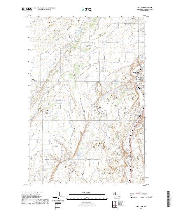
2023 Map of Mesa West
USGS Topo · Published 2023About this map
The town of Mesa serves as a focal point for this section of Franklin County, where the desert landscape has been transformed by large-scale irrigation. The Potholes Canal meanders through the western half of the map, a critical artery for the regional agricultural economy that feeds numerous water bodies like Worth Lake and Clark Pond. The terrain is defined by dramatic geological depressions, most notably Esquatzel Coulee and Old Maid Coulee, which run parallel to the transport corridor on the eastern edge. Settlement patterns are tied to the rail and road infrastructure near Edwards, while the interior remains a grid of rural roads such as Sheffield Rd and Klamath Rd. This survey documents a sophisticated water management system, including the Bernsens 810 Reservoir, illustrating how modern engineering sustains life in the arid Columbia Basin. Small aviation history is also noted at the Slinkard Airfield, situated near the canal’s upper reaches.
Find a feature on this map
49 named features on this map. Tap any name to fly to it.
Don’t see what you’re looking for? This feature index may not catch every label — zoom into the map to look around manually.
Map Details
Editions of this 2023 Mesa West Map
This is the sole edition of this map. No revisions or reprints were ever made.
Other maps of this area

1915 · Wallulah
USGS Topo · 1:96,000

1916 · Connell
USGS Topo · 1:125,000

1917 · Pasco
USGS Topo · 1:125,000

1918 · Connell
USGS Topo · 1:125,000

1918 · Wallula
USGS Topo · 1:125,000

1925 · Scooteney Lake
USGS Topo · 1:62,500

1951 · Scooteney Lake
USGS Topo · 1:62,500

1953 · Walla Walla
USGS Topo · 1:250,000

1958 · Walla Walla
USGS Topo · 1:250,000

1963 · Rye Grass Coulee
USGS Topo · 1:24,000