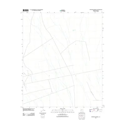
2011 Map of Mesquite Jim Well
USGS Topo · Published 2011About this map
Yuma Proving Ground dominates the southeastern portion of this desert landscape in Yuma County, reflecting the area's ongoing significance for military testing and evaluation. The terrain is characterized by a network of ephemeral washes and drainage patterns that converge across the arid flats. Water access is traditionally marked by specific points like Mesquite Jim Well, a vital landmark in this water-scarce environment. Transportation through the area is limited to a handful of routes, including Co 5th St S, which provides a formal road structure through the sparse open country. This survey illustrates the modern intersection of military land use and the natural hydrological network of the Arizona desert.
Find a feature on this map
3 named features on this map. Tap any name to fly to it.
Don’t see what you’re looking for? This feature index may not catch every label — zoom into the map to look around manually.
Map Details
Editions of this 2011 Mesquite Jim Well Map
This is the sole edition of this map. No revisions or reprints were ever made.
Other maps of this area

1928 · Norton
USGS Topo · 1:62,500

1929 · Norton
USGS Topo · 1:62,500

1930 · Stoval
USGS Topo · 1:62,500

1942 · Vicksburg
USGS Topo · 1:250,000

1950 · Stoval
USGS Topo · 1:62,500

1953 · Ajo
USGS Topo · 1:250,000

1954 · Phoenix
USGS Topo · 1:250,000

1955 · Growler
USGS Topo · 1:24,000
1955 · Roll
USGS Topo · 1:24,000

1955 · Roll
USGS Topo · 1:62,500