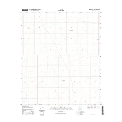
2014 Map of Mesquite Jim Well
USGS Topo · Published 2014About this map
Mesquite Jim Well is the defining hydrological feature of this arid landscape in Yuma County, positioned within the grid of township boundaries including t5s r15w. This 2014 survey documents a territory dominated by terrain and the Public Land Survey System, illustrating how water sources like the well served as critical anchors for navigation and potential land use in the desert. The presence of E Costh St N in the southern portion of the quadrangle represents one of the few named transportation markers in a region otherwise defined by open topography and the intersections of t6s r15w and t5s r16w.
Find a feature on this map
6 named features on this map. Tap any name to fly to it.
Don’t see what you’re looking for? This feature index may not catch every label — zoom into the map to look around manually.
Map Details
Editions of this 2014 Mesquite Jim Well Map
This is the sole edition of this map. No revisions or reprints were ever made.
Other maps of this area

1928 · Norton
USGS Topo · 1:62,500

1929 · Norton
USGS Topo · 1:62,500

1930 · Stoval
USGS Topo · 1:62,500

1942 · Vicksburg
USGS Topo · 1:250,000

1950 · Stoval
USGS Topo · 1:62,500

1953 · Ajo
USGS Topo · 1:250,000

1954 · Phoenix
USGS Topo · 1:250,000

1955 · Growler
USGS Topo · 1:24,000
1955 · Roll
USGS Topo · 1:24,000

1955 · Roll
USGS Topo · 1:62,500