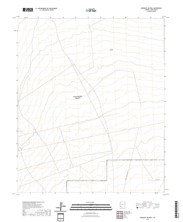
2021 Map of Mesquite Jim Well
USGS Topo · Published 2021About this map
Mesquite Jim Well anchors this remote desert landscape in eastern Yuma County, serving as a critical water point in an otherwise arid expanse. The terrain is defined by the rigid grid of the Public Land Survey System, with the intersection of t5s r15w and t6s r15w marking the transition across these desolate townships. Development is sparse, represented primarily by thin transit corridors such as the Norton To Harquahala Rd and Co 5th St S. This 2021 survey illustrates a region where human footprint is minimal, limited to essential ranching infrastructure and desert tracks that navigate the subtle shifts in elevation across the basin floor. The map offers a clear view of the modern survey lines and the isolation characteristic of the southwestern Arizona desert.
Find a feature on this map
8 named features on this map. Tap any name to fly to it.
Don’t see what you’re looking for? This feature index may not catch every label — zoom into the map to look around manually.
Map Details
Editions of this 2021 Mesquite Jim Well Map
This is the sole edition of this map. No revisions or reprints were ever made.
Other maps of this area

1928 · Norton
USGS Topo · 1:62,500

1929 · Norton
USGS Topo · 1:62,500

1930 · Stoval
USGS Topo · 1:62,500

1942 · Vicksburg
USGS Topo · 1:250,000

1950 · Stoval
USGS Topo · 1:62,500

1953 · Ajo
USGS Topo · 1:250,000

1954 · Phoenix
USGS Topo · 1:250,000

1955 · Growler
USGS Topo · 1:24,000
1955 · Roll
USGS Topo · 1:24,000

1955 · Roll
USGS Topo · 1:62,500