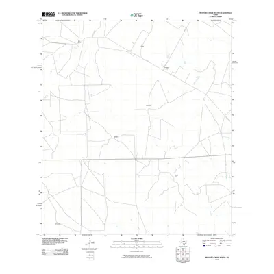
2010 Map of Mesteno Creek South
USGS Topo · Published 2010About this map
Large cattle ranches and private estates define the landscape of Webb County in the early 21st century. The terrain is characterized by dispersed homesteads and agrarian operations, including the Bell Ranch, Star Ranch, and Krueger Ranch. This era shows a network of local thoroughfares such as Raices Rd and Kruger Rd that connect the remote properties. Natural drainage follows the paths of Jaboncillo Creek and Chucareto Creek, which meander through the brushland. For those researching local landowners, the map identifies specific residential sites like J Breeding, James Ranch, and Mrs B Carr, offering a clear view of property distribution before further modernization or subdivision. The map serves as a detailed record of South Texas ranching life, where water sources and family-held lands remain the primary points of reference.
Find a feature on this map
11 named features on this map. Tap any name to fly to it.
Don’t see what you’re looking for? This feature index may not catch every label — zoom into the map to look around manually.
Map Details
Editions of this 2010 Mesteno Creek South Map
This is the sole edition of this map. No revisions or reprints were ever made.
Other maps of this area

1929 · Cotulla
USGS Topo · 1:125,000

1940 · Velenzuela Creek
USGS Topo · 1:62,500

1953 · Crystal City
USGS Topo · 1:250,000

1955 · Crystal City
USGS Topo · 1:250,000

1956 · Las Tiendas
USGS Topo · 1:62,500

1956 · Webb
USGS Topo · 1:62,500

1956 · Laredo
USGS Topo · 1:250,000

1957 · Encinal
USGS Topo · 1:62,500

1961 · Crystal City
USGS Topo · 1:250,000

1965 · Spohn Ranch
USGS Topo · 1:24,000