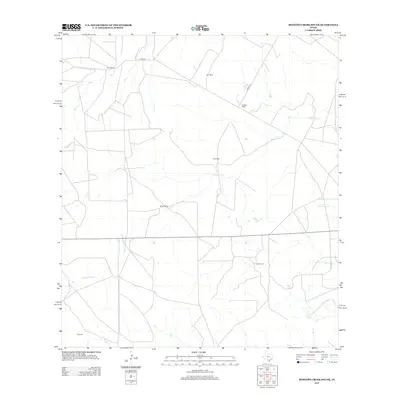
2013 Map of Mesteno Creek South
USGS Topo · Published 2013About this map
Bell Ranch and Star Ranch anchor the northern landscape of this South Texas quadrangle, where the economy is defined by large landholdings and sprawling ranching operations. The terrain is drained by several seasonal waterways, most notably Jabonçillo Cr, which winds across the central and southern portions of the territory. This 2013 survey provides a detailed view of individual homesteads and rural properties, including those of J Breeding, Mrs B Carr, and B Dunbar, offering specific location data for genealogists and local historians tracking family lineage in this part of Webb County. The presence of James Ranch and Krueger Ranch further illustrates the established ranching culture of the region, connected by rural corridors such as Alamo Rd and Raices Rd.
Find a feature on this map
11 named features on this map. Tap any name to fly to it.
Don’t see what you’re looking for? This feature index may not catch every label — zoom into the map to look around manually.
Map Details
Editions of this 2013 Mesteno Creek South Map
This is the sole edition of this map. No revisions or reprints were ever made.
Other maps of this area

1929 · Cotulla
USGS Topo · 1:125,000

1940 · Velenzuela Creek
USGS Topo · 1:62,500

1953 · Crystal City
USGS Topo · 1:250,000

1955 · Crystal City
USGS Topo · 1:250,000

1956 · Las Tiendas
USGS Topo · 1:62,500

1956 · Webb
USGS Topo · 1:62,500

1956 · Laredo
USGS Topo · 1:250,000

1957 · Encinal
USGS Topo · 1:62,500

1961 · Crystal City
USGS Topo · 1:250,000

1965 · Spohn Ranch
USGS Topo · 1:24,000