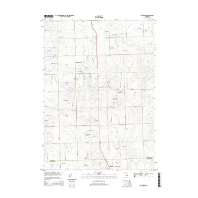
2014 Map of Metamora
USGS Topo · Published 2014About this map
The village of Metamora sits at the center of this landscape in Lapeer and Oakland Counties, defined by a dense network of glacial lakes and small settlements. The area shows a transition from historical agriculture and rural crossroads like Farmers Creek and Thomas to modern leisure developments, evidenced by the Metamora Golf and Country Club. Geologic features such as Mt Christie provide significant elevation changes relative to the surrounding lowlands and drains.
Find a feature on this map
125 named features on this map. Tap any name to fly to it.
Don’t see what you’re looking for? This feature index may not catch every label — zoom into the map to look around manually.
Map Details
Editions of this 2014 Metamora Map
This is the sole edition of this map. No revisions or reprints were ever made.
Other maps of this area

1943 · Ortonville
USGS Topo · 1:24,000

1943 · Lake Orion
USGS Topo · 1:24,000

1943 · Oxford
USGS Topo · 1:24,000

1943 · Metamora
USGS Topo · 1:24,000

1945 · Thornville
USGS Topo · 1:24,000

1945 · Oxford
USGS Topo · 1:24,000
1945 · Ortonville
USGS Topo · 1:24,000

1945 · Hadley
USGS Topo · 1:24,000
1945 · Lake Orion
USGS Topo · 1:24,000

1946 · Metamora
USGS Topo · 1:24,000