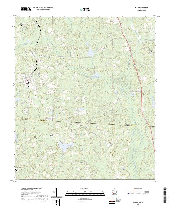
2024 Map of Metcalf
USGS Topo · Published 2024About this map
Metcalf and the surrounding borderlands of Thomas and Jefferson Counties define this rural landscape on the edge of Georgia and Florida. The settlement of Metcalf is detailed with its street grid, including Broad St and N Haines St, while smaller nodes like Fincher and Glasgow anchor the outlying agricultural areas. Numerous family and community burial grounds, such as Friendship Cem and the Old Union African American Cem, suggest a deeply rooted local history and long-standing family lineages across the state line.
Find a feature on this map
50 named features on this map. Tap any name to fly to it.
Don’t see what you’re looking for? This feature index may not catch every label — zoom into the map to look around manually.
Map Details
Editions of this 2024 Metcalf Map
This is the sole edition of this map. No revisions or reprints were ever made.
Other maps of this area

1954 · Valdosta
USGS Topo · 1:250,000

1954 · Tallahassee
USGS Topo · 1:250,000

1956 · Monticello NE
USGS Topo · 1:24,000

1956 · Cairo
USGS Topo · 1:62,500

1956 · Metcalf
USGS Topo · 1:24,000

1957 · Miccosukee NE
USGS Topo · 1:24,000

1957 · Thomasville
USGS Topo · 1:62,500

1958 · Valdosta
USGS Topo · 1:250,000

1959 · Tallahassee
USGS Topo · 1:250,000

1959 · Valdosta
USGS Topo · 1:250,000