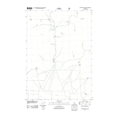
2011 Map of Methodist Creek
USGS Topo · Published 2011About this map
Asay Ranch sits within a landscape defined by the deep incisions of the Lost River Range and a complex network of agricultural water management. The terrain is marked by a series of named drainages including Blue Jay Canyon, Rocky Canyon, and Crows Nest Canyon, which feed toward the valley floor. Irrigation infrastructure is prominent in the southern portion of the quadrangle, where the Burnett Ditch, Fury Ditch, and Angelo Ditch channel water through the high desert environment. Recreational and natural landmarks such as Bear Creek Campground, the high-elevation Twin Lakes, and Mud Lake indicate the area's dual role as both a working cattle landscape and a destination for back-country exploration. The primary north-south artery, Pass Creek Rd, connects these remote canyons and ranching outposts.
Find a feature on this map
30 named features on this map. Tap any name to fly to it.
Don’t see what you’re looking for? This feature index may not catch every label — zoom into the map to look around manually.
Map Details
Editions of this 2011 Methodist Creek Map
This is the sole edition of this map. No revisions or reprints were ever made.
Other maps of this area

1935 · MacKay
USGS Topo · 1:96,000

1935 · Borah Peak
USGS Topo · 1:125,000

1938 · Borah Peak
USGS Topo · 1:125,000

1940 · Mackay
USGS Topo · 1:62,500

1955 · Dubois
USGS Topo · 1:250,000

1955 · Idaho Falls
USGS Topo · 1:250,000

1957 · Hawley Mountain
USGS Topo · 1:62,500

1958 · Dubois
USGS Topo · 1:250,000

1958 · Idaho Falls
USGS Topo · 1:250,000

1960 · Mackay
USGS Topo · 1:62,500