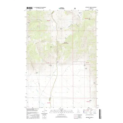
2017 Map of Methodist Creek
USGS Topo · Published 2017About this map
The Lost River Range and Challis National Forest dominate this landscape on the border of Custer and Butte Counties. The terrain is defined by a deep network of drainage systems, including Blue Jay Canyon, Rocky Canyon, and Maddock Canyon. Water management is evident in the lower elevations through several named irrigation channels such as Hanson Ditch, Burnett Ditch, and Fury Ditch, which redirect flow from mountain sources to the valley floor. High-altitude landmarks like Invisible Mtn and Bear Creek Lake are accessible via the Bear-Wet Creek Trail, illustrating the remote character of this wilderness area. The primary north-south artery, Pass Creek Rd, follows the course of Pass Creek through the central canyon corridor, providing a singular path through the steep topographic relief of the region.
Find a feature on this map
40 named features on this map. Tap any name to fly to it.
Don’t see what you’re looking for? This feature index may not catch every label — zoom into the map to look around manually.
Map Details
Editions of this 2017 Methodist Creek Map
This is the sole edition of this map. No revisions or reprints were ever made.
Other maps of this area

1935 · MacKay
USGS Topo · 1:96,000

1935 · Borah Peak
USGS Topo · 1:125,000

1938 · Borah Peak
USGS Topo · 1:125,000

1940 · Mackay
USGS Topo · 1:62,500

1955 · Dubois
USGS Topo · 1:250,000

1955 · Idaho Falls
USGS Topo · 1:250,000

1957 · Hawley Mountain
USGS Topo · 1:62,500

1958 · Dubois
USGS Topo · 1:250,000

1958 · Idaho Falls
USGS Topo · 1:250,000

1960 · Mackay
USGS Topo · 1:62,500