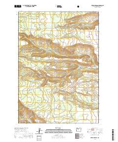
2020 Map of Metolius Bench
USGS Topo · Published 2020About this map
Metolius Wild and Scenic River defines the southwestern corner of this area, where the high plateaus of central Oregon meet the river's deep drainage system. The landscape is characterized by prominent flat-topped elevations including Tenino Bench and Metolius Bench, separated by a network of seasonal watercourses and springs. A dense grid of forest and Bureau of Indian Affairs routes, such as BIA Rd 25 and NW Upper Crossing Rd, crisscrosses the terrain, indicating the ongoing management of these timbered lands within the Deschutes National Forest. Significant drainage systems like Seekseequa Cr and the S Fork Seekseequa Cr cut eastward across the quadrangle, while smaller features like Beachcomb Spring and Squeeksville Spring provide essential water points in this arid, high-elevation environment. The presence of Box Canyon further illustrates the complex erosional patterns that have shaped this portion of Jefferson County.
Find a feature on this map
52 named features on this map. Tap any name to fly to it.
Don’t see what you’re looking for? This feature index may not catch every label — zoom into the map to look around manually.
Map Details
Editions of this 2020 Metolius Bench Map
This is the sole edition of this map. No revisions or reprints were ever made.
Other maps of this area

1927 · Mt. Jefferson
USGS Topo · 1:125,000

1928 · Madras
USGS Topo · 1:125,000

1930 · Mt. Jefferson
USGS Topo · 1:125,000

1931 · Madras
USGS Topo · 1:125,000

1955 · Bend
USGS Topo · 1:250,000

1957 · Bend
USGS Topo · 1:250,000

1958 · Bend
USGS Topo · 1:250,000

1961 · Whitewater River
USGS Topo · 1:62,500

1961 · Fort Butte
USGS Topo · 1:62,500

1962 · Metolius Bench
USGS Topo · 1:24,000