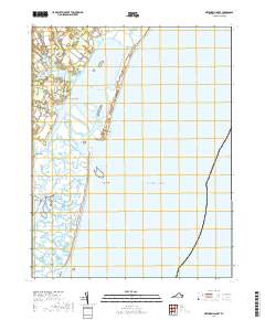
2019 Map of Metompkin Inlet
USGS Topo · Published 2019About this map
Parker Neck and Baylys Neck define the western shoreline of this Virginia coastal landscape, where the mainland gives way to a complex network of marshland guts and tidal channels. The Virginia Inside Passage serves as the primary artery through Metompkin Bay, shielded from the Atlantic Ocean by the narrow, shifting barrier of the Metompkin Islands. Local life and navigation follow the ebb and flow of features like Metompkin Inlet and Warwick Channel, which provide vital access between the back bays and the open sea.
Find a feature on this map
52 named features on this map. Tap any name to fly to it.
Don’t see what you’re looking for? This feature index may not catch every label — zoom into the map to look around manually.
Map Details
Editions of this 2019 Metompkin Inlet Map
This is the sole edition of this map. No revisions or reprints were ever made.
Other maps of this area

1931 · Accomac
USGS Topo · 1:48,000

1935 · Accomac
USGS Topo · 1:62,500

1942 · Mappsville
USGS Topo · 1:24,000

1942 · Wallops Island
USGS Topo · 1:24,000

1942 · Parksley
USGS Topo · 1:24,000

1943 · Parksley
USGS Topo · 1:31,680

1943 · Mappsville
USGS Topo · 1:31,680

1943 · Wallops Island
USGS Topo · 1:31,680

1946 · Eastville
USGS Topo · 1:250,000
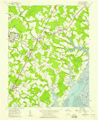
1957 · Accomac
USGS Topo · 1:24,000