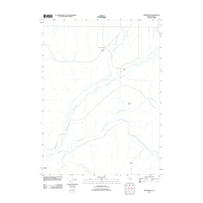
2012 Map of Metropolis
USGS Topo · Published 2012About this map
Metropolis (historical) anchors this high-desert landscape in Elko County, marking the remains of a once-ambitious agricultural colony that flourished briefly in the early 20th century. The surrounding terrain is defined by the drainage network of the Humboldt River, which flows across the southern portion of the sheet near Alazon. The presence of the Metropolis Cemetery and the Knudson Ranch provides tangible links for genealogists and local historians tracing the settlement patterns and ranching history of northeastern Nevada. Water rights and irrigation were central to the story of this area, evidenced by the convergence of Bishop Creek and Trout Creek as they flow toward the Bishop Flats. The map documents a landscape where natural watercourses like Willow Creek and Burnt Creek intersect with local infrastructure like Co RD 754, reflecting the area's continued use for ranching long after the primary townsite faded.
Find a feature on this map
12 named features on this map. Tap any name to fly to it.
Don’t see what you’re looking for? This feature index may not catch every label — zoom into the map to look around manually.
Map Details
Editions of this 2012 Metropolis Map
This is the sole edition of this map. No revisions or reprints were ever made.
Other maps of this area

1955 · Wells
USGS Topo · 1:250,000

1958 · Wells
USGS Topo · 1:250,000

1961 · Wells
USGS Topo · 1:250,000

1967 · Black Butte SW
USGS Topo · 1:24,000

1967 · Black Butte
USGS Topo · 1:24,000

1967 · Welcome
USGS Topo · 1:24,000

1967 · Herder Creek
USGS Topo · 1:24,000

1967 · Metropolis
USGS Topo · 1:24,000
1967 · Tabor Flats
USGS Topo · 1:24,000

1968 · Wells
USGS Topo · 1:24,000