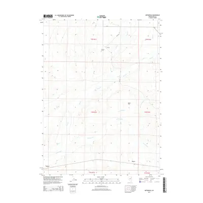
2015 Map of Metropolis
USGS Topo · Published 2015About this map
Metropolis stands as a focal point in this high-desert Elko County landscape, an area defined by the historic attempted agricultural colony of the early 20th century. The mapping of the Metropolis Cemetery provides a specific point of reference for genealogists and local historians tracking the families of the original townsite. To the south, the rail-oriented settlements of Alazon and Tulasco are positioned along the transportation corridor that follows the valley floor. The hydrology of the region is centered on the Humboldt River, which is fed by a network of drainage systems including Bishop Creek, Willow Creek, and Trout Creek. These waterways converge near Bishop Flats, illustrating the precarious water management required for settlement in this part of Nevada. The public land survey system grid, including townships like t39n r61e and t38n r62e, overlays the terrain, marking the administrative boundaries of the Great Basin.
Find a feature on this map
11 named features on this map. Tap any name to fly to it.
Don’t see what you’re looking for? This feature index may not catch every label — zoom into the map to look around manually.
Map Details
Editions of this 2015 Metropolis Map
This is the sole edition of this map. No revisions or reprints were ever made.
Other maps of this area

1955 · Wells
USGS Topo · 1:250,000

1958 · Wells
USGS Topo · 1:250,000

1961 · Wells
USGS Topo · 1:250,000

1967 · Black Butte SW
USGS Topo · 1:24,000

1967 · Black Butte
USGS Topo · 1:24,000

1967 · Welcome
USGS Topo · 1:24,000

1967 · Herder Creek
USGS Topo · 1:24,000

1967 · Metropolis
USGS Topo · 1:24,000
1967 · Tabor Flats
USGS Topo · 1:24,000

1968 · Wells
USGS Topo · 1:24,000