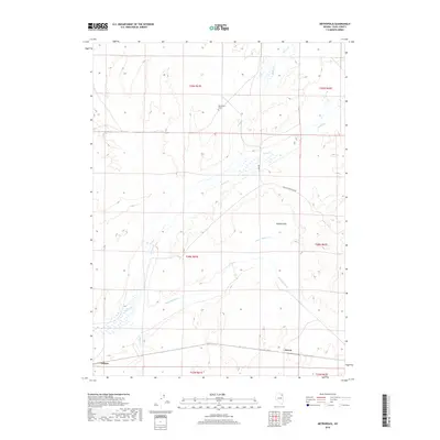
2018 Map of Metropolis
USGS Topo · Published 2018About this map
The Metropolis Cem serves as a lone marker of the early twentieth-century agricultural community that once attempted to bloom in this part of Elko County. Situated near Bishop Flats, the landscape is defined by the convergence of several drainages, including Bishop Cr, Trout Cr, and Burnt Cr, which flow toward the southern valley. This 2018 survey illustrates the modern transportation and hydrographic network, showing how the Humboldt River shapes the southern reaches of the quadrangle near the settlements of Alazon and Tulasco. The presence of the Lower Metropolis Rd and various BLM RD routes reflects the area's ongoing use for ranching and public land access. Genealogists and local historians can use these contemporary coordinates to locate family sites and historical landmarks within the traditional township and range divisions, such as t39n r61e.
Find a feature on this map
19 named features on this map. Tap any name to fly to it.
Don’t see what you’re looking for? This feature index may not catch every label — zoom into the map to look around manually.
Map Details
Editions of this 2018 Metropolis Map
This is the sole edition of this map. No revisions or reprints were ever made.
Other maps of this area

1955 · Wells
USGS Topo · 1:250,000

1958 · Wells
USGS Topo · 1:250,000

1961 · Wells
USGS Topo · 1:250,000

1967 · Black Butte SW
USGS Topo · 1:24,000

1967 · Black Butte
USGS Topo · 1:24,000

1967 · Welcome
USGS Topo · 1:24,000

1967 · Herder Creek
USGS Topo · 1:24,000

1967 · Metropolis
USGS Topo · 1:24,000
1967 · Tabor Flats
USGS Topo · 1:24,000

1968 · Wells
USGS Topo · 1:24,000