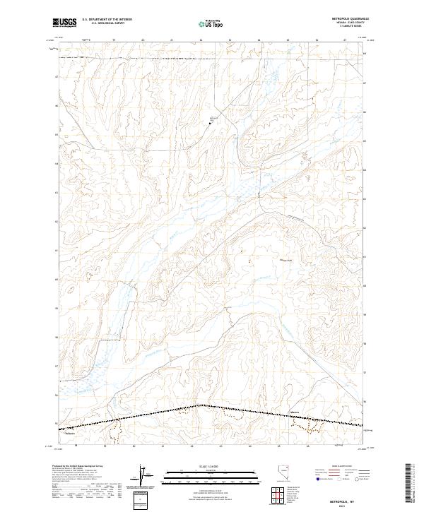
2021 Map of Metropolis
USGS Topo · Published 2021About this map
Metropolis Cem remains as a focal point of local history in this corner of Elko County, marking the site of a community that once envisioned a different future for this high desert landscape. The terrain is defined by the drainage systems of Bishop Cr and Lower Bishop Cr, which flow toward the southern corridor where the Humboldt River shapes the valley floor. These waterways provided the vital irrigation for the agricultural efforts on Bishop Flats, an area where the grid of sections and rural tracks like Lower Metropolis Rd suggest a history of planned settlement and land use.
Find a feature on this map
19 named features on this map. Tap any name to fly to it.
Don’t see what you’re looking for? This feature index may not catch every label — zoom into the map to look around manually.
Map Details
Editions of this 2021 Metropolis Map
This is the sole edition of this map. No revisions or reprints were ever made.
Other maps of this area

1955 · Wells
USGS Topo · 1:250,000

1958 · Wells
USGS Topo · 1:250,000

1961 · Wells
USGS Topo · 1:250,000

1967 · Black Butte SW
USGS Topo · 1:24,000

1967 · Black Butte
USGS Topo · 1:24,000

1967 · Welcome
USGS Topo · 1:24,000

1967 · Herder Creek
USGS Topo · 1:24,000

1967 · Metropolis
USGS Topo · 1:24,000
1967 · Tabor Flats
USGS Topo · 1:24,000

1968 · Wells
USGS Topo · 1:24,000