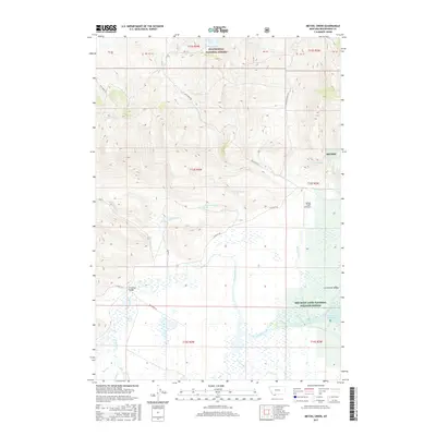
2017 Map of Metzel Creek
USGS Topo · Published 2017About this map
Beaverhead National Forest and the expansive Red Rock Lakes National Wildlife Refuge dominate this high-elevation landscape in Beaverhead County. The map documents a complex hydrology where the Red Rock River meanders through the marshy floor of the Centennial Valley, fed by numerous tributaries including Metzel Creek, Murphy Cr, and Curry Creek. This area is characterized by its vital wetlands and spring systems, such as the curiously named Lousy Spring Springs and 13S02W18ADC_01 Spring. Human infrastructure is sparse, restricted to primary access routes like N Valley Rd and Gravelly Range Rd, alongside local landmarks like the Metzel Creek Airport and the Brundage Bridge crossing Brundage Cr. The southern portion of the map shows the transition into the waters of Lower Red Rock Lake, a critical habitat focal point.
Find a feature on this map
41 named features on this map. Tap any name to fly to it.
Don’t see what you’re looking for? This feature index may not catch every label — zoom into the map to look around manually.
Map Details
Editions of this 2017 Metzel Creek Map
This is the sole edition of this map. No revisions or reprints were ever made.
Other maps of this area

1950 · Lower Red Rock Lake
USGS Topo · 1:62,500

1950 · Monument Ridge
USGS Topo · 1:62,500

1955 · Dubois
USGS Topo · 1:250,000

1955 · Ashton
USGS Topo · 1:250,000

1958 · Dubois
USGS Topo · 1:250,000

1958 · Ashton
USGS Topo · 1:250,000

1960 · Ashton
USGS Topo · 1:250,000

1968 · Stonehouse Mountain
USGS Topo · 1:24,000

1968 · Big Table Mountain
USGS Topo · 1:24,000

1968 · Antelope Peak
USGS Topo · 1:24,000