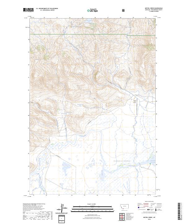
2024 Map of Metzel Creek
USGS Topo · Published 2024About this map
Centennial Valley anchors this high-elevation landscape in Beaverhead County, where the Red Rock River meanders toward the expanse of Lower Red Rock Lake. The map details a significant conservation landscape, including the Red Rock Lakes National Wildlife Refuge and the protected Red Rock Lakes Wilderness. To the north, the terrain rises into the Beaverhead National Forest, defined by drainages such as Fish Creek and Metzel Creek. Small-scale aviation is represented by the Metzel Creek Airport, while the presence of named water sources like Lousy Springs and Fish Creek Lake reflects the region's essential hydrography. The road network, including Fish Creek Rd and Gravelly Range Rd, suggests the remote, managed nature of this Montana backcountry.
Find a feature on this map
35 named features on this map. Tap any name to fly to it.
Don’t see what you’re looking for? This feature index may not catch every label — zoom into the map to look around manually.
Map Details
Editions of this 2024 Metzel Creek Map
This is the sole edition of this map. No revisions or reprints were ever made.
Other maps of this area

1950 · Lower Red Rock Lake
USGS Topo · 1:62,500

1950 · Monument Ridge
USGS Topo · 1:62,500

1955 · Dubois
USGS Topo · 1:250,000

1955 · Ashton
USGS Topo · 1:250,000

1958 · Dubois
USGS Topo · 1:250,000

1958 · Ashton
USGS Topo · 1:250,000

1960 · Ashton
USGS Topo · 1:250,000

1968 · Stonehouse Mountain
USGS Topo · 1:24,000

1968 · Big Table Mountain
USGS Topo · 1:24,000

1968 · Antelope Peak
USGS Topo · 1:24,000