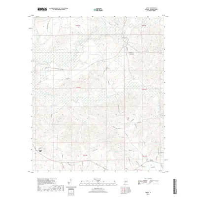
2018 Map of Mexia
USGS Topo · Published 2018About this map
Fountain and Mexia anchor this corner of Monroe County, where the landscape is defined by the winding course of Big Flat Creek and its many tributaries. The area is marked by a deep-rooted rural character, with family-named landmarks like W Sam Carpenters Lake and Graham Bridge indicating the local importance of water access. The terrain around Mineral Springs suggests the natural features that historically influenced settlement patterns in this part of Alabama.
Find a feature on this map
56 named features on this map. Tap any name to fly to it.
Don’t see what you’re looking for? This feature index may not catch every label — zoom into the map to look around manually.
Map Details
Editions of this 2018 Mexia Map
This is the sole edition of this map. No revisions or reprints were ever made.
Other maps of this area

1953 · Andalusia
USGS Topo · 1:250,000

1957 · Andalusia
USGS Topo · 1:250,000

1972 · Monroeville
USGS Topo · 1:24,000

1972 · Frisco City
USGS Topo · 1:24,000

1972 · Natchez
USGS Topo · 1:24,000

1972 · Franklin
USGS Topo · 1:24,000

1972 · Excel
USGS Topo · 1:24,000

1972 · Mexia
USGS Topo · 1:24,000

1972 · Flynns Lake
USGS Topo · 1:24,000

1972 · Claiborne
USGS Topo · 1:24,000