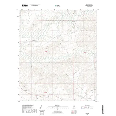
2020 Map of Mexia
USGS Topo · Published 2020About this map
Fountain and Perdue Hill anchor this rural landscape in Monroe County, where the topography is defined by the winding paths of Big Flat Creek and Limestone Creek. This modern survey reveals a network of local roads and land divisions that persist around the small settlement of Mexia in the southeast. Historical continuity is evident in the numerous family and community burial grounds, such as Carry Mount Cem and Wiggins Cem, which are tucked away near watercourses like Little Mill Cr.
Find a feature on this map
57 named features on this map. Tap any name to fly to it.
Don’t see what you’re looking for? This feature index may not catch every label — zoom into the map to look around manually.
Map Details
Editions of this 2020 Mexia Map
This is the sole edition of this map. No revisions or reprints were ever made.
Other maps of this area

1953 · Andalusia
USGS Topo · 1:250,000

1957 · Andalusia
USGS Topo · 1:250,000

1972 · Monroeville
USGS Topo · 1:24,000

1972 · Frisco City
USGS Topo · 1:24,000

1972 · Natchez
USGS Topo · 1:24,000

1972 · Franklin
USGS Topo · 1:24,000

1972 · Excel
USGS Topo · 1:24,000

1972 · Mexia
USGS Topo · 1:24,000

1972 · Flynns Lake
USGS Topo · 1:24,000

1972 · Claiborne
USGS Topo · 1:24,000