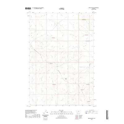
2020 Map of Mexican Buttes
USGS Topo · Published 2020About this map
Mexican Buttes and Twin Buttes rise above the high plains where Yellowstone Co meets Treasure Co in this 2020 topographic survey. The landscape is defined by its drainage systems, including the headwaters of Butte Cr, Mc Cloud Coulee, and the branches of Horse Creek. Transportation in this sparsely populated region of Montana is limited to local routes such as Musselshell Trail Rd and Allen Creek Rd, which wind through the complex network of draws and coulees.
Find a feature on this map
16 named features on this map. Tap any name to fly to it.
Don’t see what you’re looking for? This feature index may not catch every label — zoom into the map to look around manually.
Map Details
Editions of this 2020 Mexican Buttes Map
This is the sole edition of this map. No revisions or reprints were ever made.
Other maps of this area

1954 · Forsyth
USGS Topo · 1:250,000

1957 · Forsyth
USGS Topo · 1:250,000

1958 · Forsyth
USGS Topo · 1:250,000

1960 · Coal Bank Creek
USGS Topo · 1:24,000

1960 · Custer
USGS Topo · 1:24,000

1979 · Hysham
USGS Topo · 1:100,000
1979 · Devils Kitchen
USGS Topo · 1:24,000

1980 · Mud Butte
USGS Topo · 1:24,000
1980 · Weed Creek West
USGS Topo · 1:24,000
1980 · Weed Creek East
USGS Topo · 1:24,000