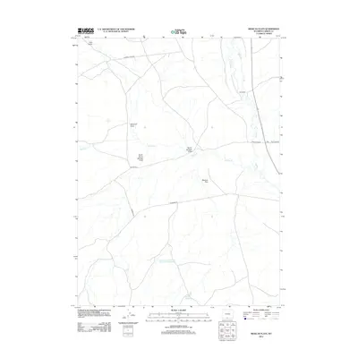
2012 Map of Mexican Flats
USGS Topo · Published 2012About this map
Mexican Flats characterizes this high-desert region of Wyoming, where seasonal water management and ranching define the land use. The presence of the Pool Ranch along the meandering course of Muddy Cr illustrates the vital connection between livestock operations and reliable water sources in an arid landscape. Further south, the Dad Larsen Detention Dam 1593 Number 6 and the Twin Reservoirs indicate sophisticated modern efforts to harness runoff from features like Red Wash and Barrel Springs Draw. This network of draws and washes, including Coal Gulch and South Barrel Springs Draw, funnels water through a terrain navigated by a system of gravel and dirt routes such as Standard Rd and Windmill Draw Rd.
Find a feature on this map
16 named features on this map. Tap any name to fly to it.
Don’t see what you’re looking for? This feature index may not catch every label — zoom into the map to look around manually.
Map Details
Editions of this 2012 Mexican Flats Map
This is the sole edition of this map. No revisions or reprints were ever made.
Other maps of this area

1954 · Rawlins
USGS Topo · 1:250,000

1957 · Baggs
USGS Topo · 1:62,500

1957 · Doty Mountain
USGS Topo · 1:62,500

1958 · Rawlins
USGS Topo · 1:250,000

1962 · Rawlins
USGS Topo · 1:250,000

1967 · Rawlins
USGS Topo · 1:250,000

1970 · South Barrel Spring
USGS Topo · 1:24,000

1970 · Mexican Flats
USGS Topo · 1:24,000
1970 · Flat Top Mountain
USGS Topo · 1:24,000

1970 · Duck Lake
USGS Topo · 1:24,000