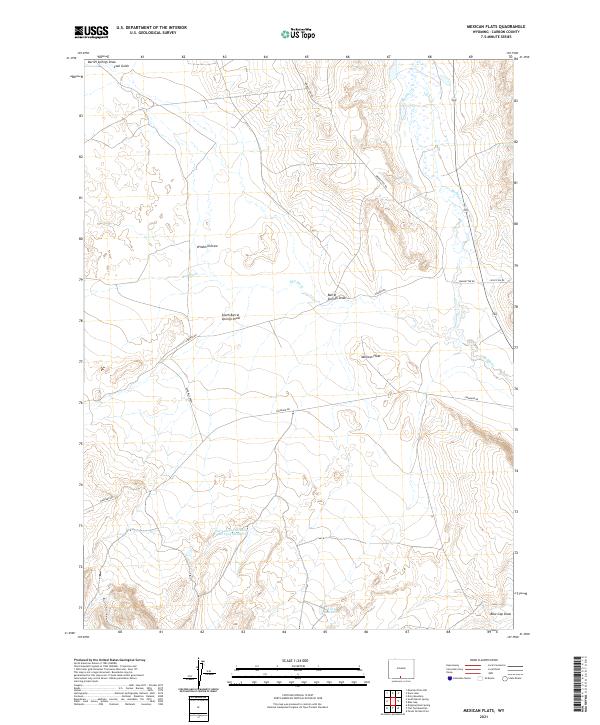
2021 Map of Mexican Flats
USGS Topo · Published 2021About this map
Mexican Flats and its surrounding drainage systems define this high-desert reach of Carbon County. The landscape is marked by intricate hydraulic management, most notably at the Dad Larsen Detention Dam 1593 Number 6 and the Twin Reservoirs to the southeast. These man-made features suggest a history of water conservation and livestock management in an otherwise arid environment.
Find a feature on this map
19 named features on this map. Tap any name to fly to it.
Don’t see what you’re looking for? This feature index may not catch every label — zoom into the map to look around manually.
Map Details
Editions of this 2021 Mexican Flats Map
This is the sole edition of this map. No revisions or reprints were ever made.
Other maps of this area

1954 · Rawlins
USGS Topo · 1:250,000

1957 · Baggs
USGS Topo · 1:62,500

1957 · Doty Mountain
USGS Topo · 1:62,500

1958 · Rawlins
USGS Topo · 1:250,000

1962 · Rawlins
USGS Topo · 1:250,000

1967 · Rawlins
USGS Topo · 1:250,000

1970 · South Barrel Spring
USGS Topo · 1:24,000

1970 · Mexican Flats
USGS Topo · 1:24,000
1970 · Flat Top Mountain
USGS Topo · 1:24,000

1970 · Duck Lake
USGS Topo · 1:24,000