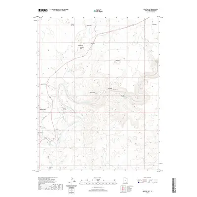
2020 Map of Mexican Hat
USGS Topo · Published 2020About this map
The San Juan River carves a deep, serpentine path through the desert landscape of southern Utah, defining the geography of the Mexican Hat settlement and the broader San Juan Valley. This 2020 map documents the dramatic geological formations of the region, from the iconic Mexican Hat Rock to the jagged spires of the Valley of the Gods. The river itself is punctuated by Gypsum Creek Rapids and flows through the steep-walled San Juan Canyon, creating a landscape shaped by water and time.
Find a feature on this map
27 named features on this map. Tap any name to fly to it.
Don’t see what you’re looking for? This feature index may not catch every label — zoom into the map to look around manually.
Map Details
Editions of this 2020 Mexican Hat Map
This is the sole edition of this map. No revisions or reprints were ever made.
Other maps of this area

1886 · Abajo
USGS Topo · 1:250,000

1892 · Abajo
USGS Topo · 1:250,000

1893 · Abajo
USGS Topo · 1:250,000

1952 · Bluff 3 SE
USGS Topo · 1:24,000
1952 · Bluff 3 SW
USGS Topo · 1:24,000

1956 · Cortez
USGS Topo · 1:250,000

1958 · Cortez
USGS Topo · 1:250,000

1959 · Cortez
USGS Topo · 1:250,000

1962 · Cortez
USGS Topo · 1:250,000

1962 · Bluff
USGS Topo · 1:62,500