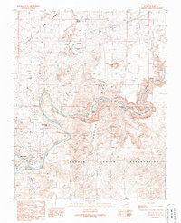
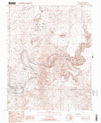
1989 Map of Mexican Hat
USGS Topo · Published 1989About this map
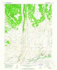
Valley of the Gods defines the northern reaches of this landscape, where distinctive sandstone formations such as Devils Window, Seven Sailors, and Scotchman Butte rise above the high desert floor. To the south, the San Juan River carves a deep path through the canyon, its course marked by the Ledge Rapids and Eight Foot Rapids. The small settlement of Mexican Hat serves as a critical crossing point, anchored by the iconic Mexican Hat Rock to its northeast. Industrial and transit activity are visible through the Radio Facility, a Landing Strip, and a Gaging Station near the riverbanks. Much of the southern portion of this sheet is dedicated to the Navajo Indian Reservation, illustrating the intersection of sovereign tribal lands and the dramatic geological transitions of southeastern Utah. The presence of a Grave and multiple Gravel Pit locations near the townsite offers specific points of interest for local history and genealogy.
Find a feature on this map
28 named features on this map. Tap any name to fly to it.
Don’t see what you’re looking for? This feature index may not catch every label — zoom into the map to look around manually.
Map Details
Editions of this 1989 Mexican Hat Map
2 editions found
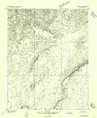
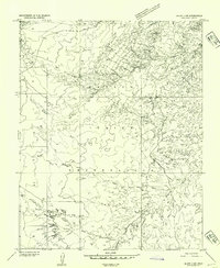
Other maps of this area

1886 · Abajo
USGS Topo · 1:250,000

1892 · Abajo
USGS Topo · 1:250,000

1893 · Abajo
USGS Topo · 1:250,000
1952 · Bluff 3 SE
USGS Topo · 1:24,000
1952 · Bluff 3 SW
USGS Topo · 1:24,000

1956 · Cortez
USGS Topo · 1:250,000

1958 · Cortez
USGS Topo · 1:250,000

1959 · Cortez
USGS Topo · 1:250,000

1962 · Cortez
USGS Topo · 1:250,000
1962 · Bluff
USGS Topo · 1:62,500