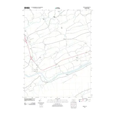
2010 Map of Mexico
USGS Topo · Published 2010About this map
Juniata River and the historic path of the Pennsylvania Canal define the southern landscape of this central Pennsylvania region. Small unincorporated communities and rural settlements are scattered throughout the hills, including Mexico, Tuscarora, Vandyke, and Locust Run. The transport infrastructure follows the natural corridors of the river valley, while further north, the terrain rises toward Lost Creek Ridge and Moyer Ridge. This area is particularly rich in family and local history markers, evidenced by a high density of rural burial grounds such as Rothrock Cemetery, Adams Cemetery, and Bookwalter Cemetery. Economic and social life is anchored by locations like Jericho Mills, Oakland Mills, and the Allen Grove Camp, reflecting a landscape deeply tied to its watercourses like Lost Creek and Cedar Spring Run.
Find a feature on this map
75 named features on this map. Tap any name to fly to it.
Don’t see what you’re looking for? This feature index may not catch every label — zoom into the map to look around manually.
Map Details
Editions of this 2010 Mexico Map
This is the sole edition of this map. No revisions or reprints were ever made.
Other maps of this area

1907 · New Bloomfield
USGS Topo · 1:62,500

1907 · Millerstown
USGS Topo · 1:62,500

1925 · Mifflintown
USGS Topo · 1:48,000

1930 · Loysville
USGS Topo · 1:62,500

1933 · Loysville
USGS Topo · 1:62,500

1934 · Mifflintown
USGS Topo · 1:62,500

1937 · Mifflintown
USGS Topo · 1:62,500

1943 · Millerstown
USGS Topo · 1:62,500

1943 · New Bloomfield
USGS Topo · 1:62,500

1950 · Harrisburg
USGS Topo · 1:250,000
Featured Places
- Tuscarora, Turbett Township
- Fayette Township, PA
- Turbett Township, PA
- Tuscarora Township, PA
- Vandyke, Walker Township