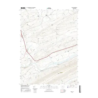
2016 Map of Mexico
USGS Topo · Published 2016About this map
Tuscarora Mountain and the Juniata River dominate this portion of the Pennsylvania landscape, where historical infrastructure and family genealogy intersect. The remnants of the Pennsylvania Canal parallel the river near Vandyke, tracing a route that once fueled the regional economy alongside the railroad. In the surrounding hills and valleys, such as Kurtz Valley, numerous family burial grounds including Rothrock Cem, Kilmer Cem, and Bookwalter Cem provide critical touchpoints for local historians. Small settlements like Oakland Mills, Jericho Mills, and Van Wert are connected by a network of rural routes like Cuba Mills Rd and Zendt Hollow Rd, reflecting a long history of milling and small-scale agriculture. The transition from the rugged slopes of Moyer Ridge to the alluvial plains of Mexico illustrates the varied terrain that shaped early settlement patterns in this part of Juniata County.
Find a feature on this map
88 named features on this map. Tap any name to fly to it.
Don’t see what you’re looking for? This feature index may not catch every label — zoom into the map to look around manually.
Map Details
Editions of this 2016 Mexico Map
This is the sole edition of this map. No revisions or reprints were ever made.
Other maps of this area

1907 · New Bloomfield
USGS Topo · 1:62,500

1907 · Millerstown
USGS Topo · 1:62,500

1925 · Mifflintown
USGS Topo · 1:48,000

1930 · Loysville
USGS Topo · 1:62,500

1933 · Loysville
USGS Topo · 1:62,500

1934 · Mifflintown
USGS Topo · 1:62,500

1937 · Mifflintown
USGS Topo · 1:62,500

1943 · Millerstown
USGS Topo · 1:62,500

1943 · New Bloomfield
USGS Topo · 1:62,500

1950 · Harrisburg
USGS Topo · 1:250,000
Featured Places
- Tuscarora, Turbett Township
- Fayette Township, PA
- Turbett Township, PA
- Tuscarora Township, PA
- Vandyke, Walker Township