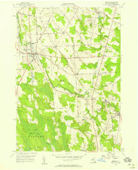
1956 Map of Mexico
USGS Topo · Published 1958About this map
The Little Salmon River meanders across this mid-century landscape, anchoring the village of Mexico and several smaller rural hamlets. This topographic study reflects an era of agrarian stability and early industrial transition in Oswego County, where the New York Central Line railroad cuts through the terrain near Maple View and Parish. The map reveals a dense network of local history, marking numerous ancestral resting places such as the Mexico Primitive Cem, St Annes Cem, and the Quaker Cem.
Find a feature on this map
60 named features on this map. Tap any name to fly to it.
Don’t see what you’re looking for? This feature index may not catch every label — zoom into the map to look around manually.
Map Details
Editions of this 1956 Mexico Map
2 editions found
Other maps of this area

1895 · Pulaski
USGS Topo · 1:62,500

1900 · Fulton
USGS Topo · 1:62,500

1905 · Mexico
USGS Topo · 1:62,500

1943 · Pulaski
USGS Topo · 1:31,680

1943 · New Haven
USGS Topo · 1:31,680

1943 · Richland
USGS Topo · 1:31,680
1943 · Mallory
USGS Topo · 1:31,680

1943 · Texas
USGS Topo · 1:31,680

1943 · Mexico
USGS Topo · 1:31,680

1943 · Pennellville
USGS Topo · 1:31,680