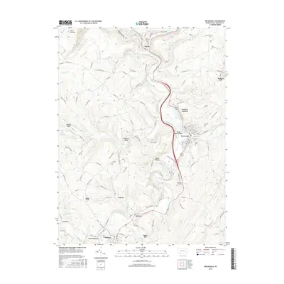
2016 Map of Meyersdale
USGS Topo · Published 2016About this map
The Casselman River winds through this region of Somerset County, carving the Casselman Gorge as it moves past the borough of Garrett. This landscape is defined by its industrial and agricultural history, where the legacy of milling and extraction is evident in names like Berkleys Mill, Engles Mill, and Shaw Mines. The town of Meyersdale serves as a central hub, surrounded by smaller settlements such as West Meyersdale and Salisbury Junction. To the south, the community of Salisbury and its neighbor West Salisbury sit near the banks of Tub Mill Run.
Find a feature on this map
109 named features on this map. Tap any name to fly to it.
Don’t see what you’re looking for? This feature index may not catch every label — zoom into the map to look around manually.
Map Details
Editions of this 2016 Meyersdale Map
This is the sole edition of this map. No revisions or reprints were ever made.
Other maps of this area

1898 · Frostburg
USGS Topo · 1:62,500

1899 · Grantsville
USGS Topo · 1:62,500

1901 · Frostburg
USGS Topo · 1:62,500

1904 · Grantsville
USGS Topo · 1:62,500

1908 · Frostburg
USGS Topo · 1:62,500

1921 · Meyersdale
USGS Topo · 1:62,500

1923 · Berlin
USGS Topo · 1:48,000

1929 · Berlin
USGS Topo · 1:62,500

1939 · Meyersdale
USGS Topo · 1:62,500

1944 · Berlin
USGS Topo · 1:62,500