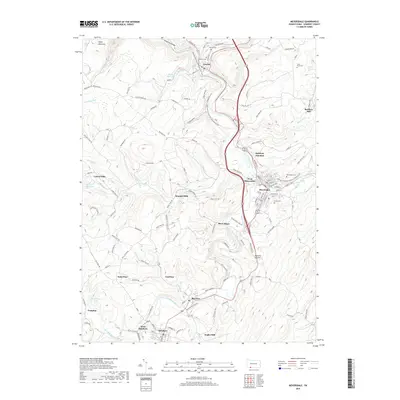
2019 Map of Meyersdale
USGS Topo · Published 2019About this map
The Casselman River carves a deep path through this Somerset County landscape, defined by its steep terrain and industrial history. The town of Meyersdale sits at a geographic crossroads, surrounded by smaller coal and mill settlements including Shaw Mines, Summit Mills, and Engles Mill. The map documents the persistent layout of these rural communities, where local heritage is preserved in numerous burial grounds like Union Cem and Highland Cem. High elevations are marked by Negro Mountain and the dramatic passage of the Casselman Gorge. Modern recreation and historical routes intersect here as the Potomac Heritage National Scenic Trail winds through the river valley, following the same corridors once vital to the region's extraction and milling economies. Smaller hamlets like Boynton and Saint Paul remain connected by the winding road network along the river's many tributaries.
Find a feature on this map
39 named features on this map. Tap any name to fly to it.
Don’t see what you’re looking for? This feature index may not catch every label — zoom into the map to look around manually.
Map Details
Editions of this 2019 Meyersdale Map
This is the sole edition of this map. No revisions or reprints were ever made.
Other maps of this area

1898 · Frostburg
USGS Topo · 1:62,500

1899 · Grantsville
USGS Topo · 1:62,500

1901 · Frostburg
USGS Topo · 1:62,500

1904 · Grantsville
USGS Topo · 1:62,500

1908 · Frostburg
USGS Topo · 1:62,500

1921 · Meyersdale
USGS Topo · 1:62,500

1923 · Berlin
USGS Topo · 1:48,000

1929 · Berlin
USGS Topo · 1:62,500

1939 · Meyersdale
USGS Topo · 1:62,500

1944 · Berlin
USGS Topo · 1:62,500