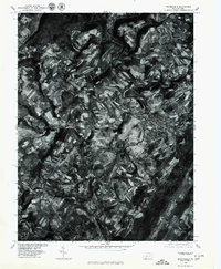
1977 Map of Meyersdale
USGS Topo · Published 1979About this map
The Casselman River carves a deep, winding path through this Somerset County landscape, dictating the development of the valley's late-1970s infrastructure. The borough of Meyersdale serves as a primary hub, showing a dense grid of streets and structures that contrast with the surrounding patchwork of upland agricultural fields and forested ridges. The orthophotographic nature of this sheet provides a direct look at the physical land use and timber patterns that topographic symbols alone cannot convey.
Find a feature on this map
7 named features on this map. Tap any name to fly to it.
Don’t see what you’re looking for? This feature index may not catch every label — zoom into the map to look around manually.
Map Details
Editions of this 1977 Meyersdale Map
This is the sole edition of this map. No revisions or reprints were ever made.
Other maps of this area

1898 · Frostburg
USGS Topo · 1:62,500

1899 · Grantsville
USGS Topo · 1:62,500

1901 · Frostburg
USGS Topo · 1:62,500

1904 · Grantsville
USGS Topo · 1:62,500

1908 · Frostburg
USGS Topo · 1:62,500

1921 · Meyersdale
USGS Topo · 1:62,500

1923 · Berlin
USGS Topo · 1:48,000

1929 · Berlin
USGS Topo · 1:62,500

1939 · Meyersdale
USGS Topo · 1:62,500

1944 · Berlin
USGS Topo · 1:62,500