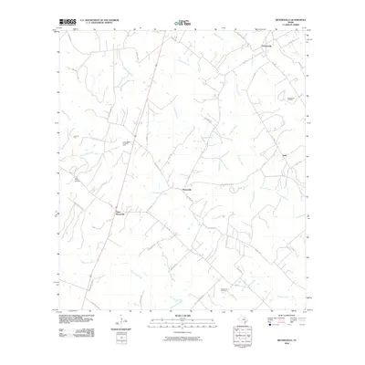
2010 Map of Meyersville
USGS Topo · Published 2010About this map
Meyersville and Upper Meyersville anchor this DeWitt County landscape, where the rural settlement patterns of South Texas are clearly defined by a network of farm-to-market roads and named creeks. The area is intersected by several numeric watercourses, including Fivemile Creek, Twelvemile Creek, and Fifteenmile Creek, which likely dictated early land parcels and transportation routes. These natural features are complemented by a significant petroleum footprint, seen in the Holly Oil Field, Cottonwood Creek Oil Field, and the Arneckeville Gas Field. For family historians, Saint Joseph Cemetery provides a specific point of interest near the creek beds. The map also captures smaller communities like Arneckeville and Golly, connected by local thoroughfares such as Golly Rd and Hopkinsville Rd, illustrating the transition from traditional ranching to modern energy extraction.
Find a feature on this map
44 named features on this map. Tap any name to fly to it.
Don’t see what you’re looking for? This feature index may not catch every label — zoom into the map to look around manually.
Map Details
Editions of this 2010 Meyersville Map
This is the sole edition of this map. No revisions or reprints were ever made.
Other maps of this area

1953 · Beeville
USGS Topo · 1:250,000

1953 · Seguin
USGS Topo · 1:250,000

1956 · Beeville
USGS Topo · 1:250,000

1958 · Seguin
USGS Topo · 1:250,000

1960 · Beeville
USGS Topo · 1:250,000

1960 · Cuero
USGS Topo · 1:24,000

1960 · Blackwell Lake
USGS Topo · 1:24,000

1962 · Verhelle
USGS Topo · 1:24,000

1963 · Meyersville
USGS Topo · 1:24,000

1963 · Weesatche
USGS Topo · 1:24,000