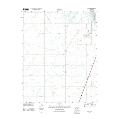
2012 Map of Miami SW
USGS Topo · Published 2012About this map
Grand Lake O the Cherokees defines the northeastern corner of this landscape, where the waters meet the expanding outskirts of Miami. The area is marked by a transition from organized residential blocks like Sunset Strip and various lettered streets to the more open rural stretches of Ottawa County. The small settlements of Dotyville and Narcissa serve as local anchors along the transportation corridors, surrounded by a complex network of named waterways including Windy Cr, Coal Cr, and Wolf Cr. Genealogists and local historians will find the Coal Creek Cem centrally located near the creek for which it was named. A distinctive aviation landmark, the Old 66 Strip Airport, sits near the center of the sheet, nodding to the region's historical connection to the famous highway corridor. The map's grid of section roads, from E 100 RD down to Schulte Dr, illustrates the enduring structure of the Oklahoma plains.
Find a feature on this map
44 named features on this map. Tap any name to fly to it.
Don’t see what you’re looking for? This feature index may not catch every label — zoom into the map to look around manually.
Map Details
Editions of this 2012 Miami SW Map
This is the sole edition of this map. No revisions or reprints were ever made.
Other maps of this area

1901 · Vinita
USGS Topo · 1:125,000

1907 · Wyandotte
USGS Topo · 1:125,000

1909 · Wyandotte
USGS Topo · 1:125,000

1913 · Vinita
USGS Topo · 1:125,000

1954 · Tulsa
USGS Topo · 1:250,000

1958 · Tulsa
USGS Topo · 1:250,000

1961 · Miami SE
USGS Topo · 1:24,000
1961 · Miami NW
USGS Topo · 1:24,000

1961 · Miami SW
USGS Topo · 1:24,000
1961 · Picher
USGS Topo · 1:24,000