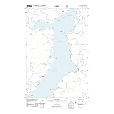
2011 Map of Mica Bay
USGS Topo · Published 2011About this map
Harrison Slough dominates this 2011 survey, defining a landscape of deep-water access points and waterfront settlements along the Idaho shoreline. The western bank features established recreational and community hubs such as the Mica Bay County Campground and the Mica Bay Access Area near the settlement of Mica. To the north, residential pockets like Lyndale Landing, Goulds Landing, and Swewla'qn Grove indicate a pattern of development closely tied to the water's edge, where many properties are reached by winding roads like W Valhalla Rd and W Mica Shore Rd.
Find a feature on this map
73 named features on this map. Tap any name to fly to it.
Don’t see what you’re looking for? This feature index may not catch every label — zoom into the map to look around manually.
Map Details
Editions of this 2011 Mica Bay Map
This is the sole edition of this map. No revisions or reprints were ever made.
Other maps of this area

1903 · Rathdrum
USGS Topo · 1:125,000

1955 · Spokane
USGS Topo · 1:250,000

1957 · St. Maries
USGS Topo · 1:62,500

1957 · Plummer
USGS Topo · 1:62,500

1957 · Coeur D'Alene
USGS Topo · 1:62,500

1957 · Lane
USGS Topo · 1:62,500

1958 · Spokane
USGS Topo · 1:250,000

1975 · Plummer NW
USGS Topo · 1:24,000

1975 · Coeur D'Alene SE
USGS Topo · 1:24,000

1975 · Plummer NE
USGS Topo · 1:24,000