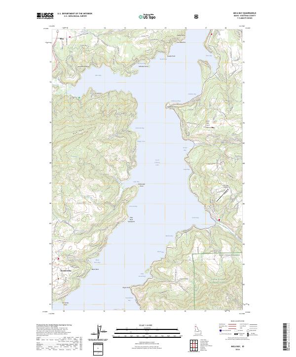
2024 Map of Mica Bay
USGS Topo · Published 2024About this map
Mica Bay and its complex network of northern inlets define this modern look at the western edge of Coeur d'Alene Lake. The landscape transition from the water's edge to the Coeur d'Alene Mountains is marked by pockets of residential and recreational development, such as Lyndale Landing and the settlement of Rockford Bay. The map documents a contemporary mix of public and private land use, where the Coeur D'Alene National Forest meets localized infrastructure like Pischl's Place Airport.
Find a feature on this map
125 named features on this map. Tap any name to fly to it.
Don’t see what you’re looking for? This feature index may not catch every label — zoom into the map to look around manually.
Map Details
Editions of this 2024 Mica Bay Map
This is the sole edition of this map. No revisions or reprints were ever made.
Other maps of this area

1903 · Rathdrum
USGS Topo · 1:125,000

1955 · Spokane
USGS Topo · 1:250,000

1957 · St. Maries
USGS Topo · 1:62,500

1957 · Plummer
USGS Topo · 1:62,500

1957 · Coeur D'Alene
USGS Topo · 1:62,500

1957 · Lane
USGS Topo · 1:62,500

1958 · Spokane
USGS Topo · 1:250,000

1975 · Plummer NW
USGS Topo · 1:24,000

1975 · Coeur D'Alene SE
USGS Topo · 1:24,000

1975 · Plummer NE
USGS Topo · 1:24,000