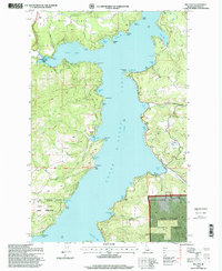
1996 Map of Mica Bay
USGS Topo · Published 1999About this map
Coeur d'Alene Lake dominates this mid-1990s landscape, its complex shoreline defined by numerous protected coves and prominent points like University Point and Pilot Rock. The eastern side of the lake shows a concentration of recreational and institutional activity, including Camp Easton and multiple landing strips, while the western shore is characterized by significant conservation and administrative boundaries. The Coeur d'Alene Indian Reservation boundary and the Coeur d'Alene National Forest meet here, reflecting the diverse land management history of the Idaho Panhandle.
Find a feature on this map
57 named features on this map. Tap any name to fly to it.
Don’t see what you’re looking for? This feature index may not catch every label — zoom into the map to look around manually.
Map Details
Editions of this 1996 Mica Bay Map
This is the sole edition of this map. No revisions or reprints were ever made.
Other maps of this area

1903 · Rathdrum
USGS Topo · 1:125,000

1955 · Spokane
USGS Topo · 1:250,000

1957 · St. Maries
USGS Topo · 1:62,500

1957 · Plummer
USGS Topo · 1:62,500

1957 · Coeur D'Alene
USGS Topo · 1:62,500

1957 · Lane
USGS Topo · 1:62,500

1958 · Spokane
USGS Topo · 1:250,000

1975 · Plummer NW
USGS Topo · 1:24,000

1975 · Coeur D'Alene SE
USGS Topo · 1:24,000

1975 · Plummer NE
USGS Topo · 1:24,000