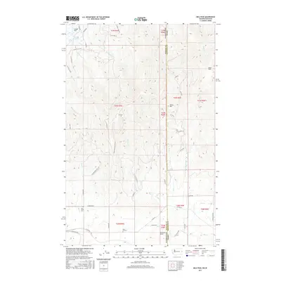
2017 Map of Mica Peak
USGS Topo · Published 2017About this map
Mica Peak and the high ridges of the Selkirk foothills dominate this landscape along the border of Washington and Idaho. The terrain transitions from the low-lying Saltese Flats and Saltese Reservoir in the northwest to the prominent heights of Round Mtn and Cable Peak. This area is defined by its drainage network, with numerous named waterways including Quinnamose Cr, California Cr, and Mica Cr carving through the slopes. Local history is anchored by the presence of both the Mica Creek Cem and Mica Peak Cem, while the Mica Peak Radar Site Rd points to the strategic utility of the mountain's summit. The boundary between Spokane County and Kootenai County runs through these summits, marking a clear divide between the agricultural valleys and the elevated timberlands of the Panhandle region.
Find a feature on this map
57 named features on this map. Tap any name to fly to it.
Don’t see what you’re looking for? This feature index may not catch every label — zoom into the map to look around manually.
Map Details
Editions of this 2017 Mica Peak Map
This is the sole edition of this map. No revisions or reprints were ever made.
Other maps of this area

1901 · Spokane
USGS Topo · 1:125,000

1903 · Oakesdale
USGS Topo · 1:125,000

1903 · Rathdrum
USGS Topo · 1:125,000

1905 · Oakesdale
USGS Topo · 1:125,000

1949 · Greenacres
USGS Topo · 1:62,500

1951 · Greenacres
USGS Topo · 1:62,500

1954 · Fairfield
USGS Topo · 1:62,500

1955 · Spokane
USGS Topo · 1:250,000

1957 · Plummer
USGS Topo · 1:62,500

1957 · Coeur D'Alene
USGS Topo · 1:62,500