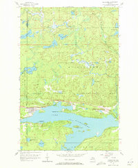
1956 Map of Michigamme
USGS Topo · Published 1972About this map
The settlement of Michigamme sits on the northwestern shore of the expansive Lake Michigamme, serving as a central hub for the mid-1950s timber and transport economy of the Upper Peninsula. The Duluth South Shore and Atlantic railroad skirts the northern edge of the lake, providing a critical link through the heavily wooded terrain of the Michigamme State Forest and Baraga State Forest. This landscape is defined by its complex hydrology, where numerous smaller bodies of water like Keewaydin Lake, Indian Lake, and Lake Sixteen are connected by a network of drainage including the West Branch Peshekee River. Near the town, Lakeview Cem and Presbytery Point offer specific landmarks for genealogical research, while the presence of named islands such as Sundstrum Island and Ramsey Island highlights the intricate shoreline that has long shaped local recreation and industry.
Find a feature on this map
28 named features on this map. Tap any name to fly to it.
Don’t see what you’re looking for? This feature index may not catch every label — zoom into the map to look around manually.
Map Details
Editions of this 1956 Michigamme Map
3 editions found
Other maps of this area

1899 · Witbeck
USGS Topo · 1:62,500

1955 · Champion
USGS Topo · 1:24,000

1955 · Witch Lake NE
USGS Topo · 1:24,000

1955 · Republic
USGS Topo · 1:62,500

1955 · Republic
USGS Topo · 1:24,000

1955 · Witch Lake
USGS Topo · 1:62,500

1955 · Champion
USGS Topo · 1:62,500

1956 · Three Lakes
USGS Topo · 1:24,000

1956 · Michigamme
USGS Topo · 1:62,500

1956 · Michigamme
USGS Topo · 1:24,000