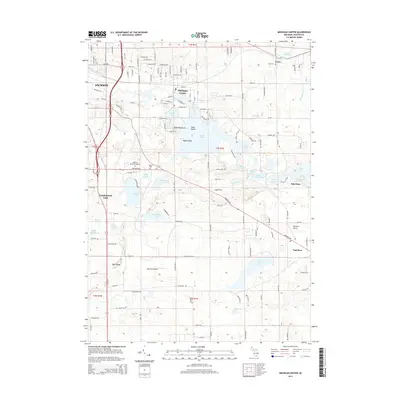
2014 Map of Michigan Center
USGS Topo · Published 2014About this map
Center Lake and its intricate shoreline dominate the geography of this Jackson County landscape, where the Grand River flows near the eastern edge of Jackson. The region is defined by a dense concentration of glacial lakes, including Wolf Lake, Olcott Lake, and Ackerson Lake, which have shaped local settlement patterns around Michigan Center and Vandercook Lake. This 2014 survey captures the suburban and rural balance of the area, featuring distinctive landforms like the Blue Ridge and Dyke Peninsula. Genealogists and local historians can locate early burial sites at Leoni Cem and Eldred Cem, while industrial and aviation history is preserved through features such as the Leoni Millpond and Napoleon Airport. The map documents a highly connected landscape of local roads and drains, illustrating how water management and transport have integrated the communities of Leoni and Napoleon over time.
Find a feature on this map
142 named features on this map. Tap any name to fly to it.
Don’t see what you’re looking for? This feature index may not catch every label — zoom into the map to look around manually.
Map Details
Editions of this 2014 Michigan Center Map
This is the sole edition of this map. No revisions or reprints were ever made.
Other maps of this area

1919 · Stockbridge
USGS Topo · 1:62,500

1919 · Rives Junction
USGS Topo · 1:62,500

1921 · Rives Junction
USGS Topo · 1:62,500

1922 · Stockbridge
USGS Topo · 1:62,500

1935 · Jackson
USGS Topo · 1:48,000

1939 · Jackson
USGS Topo · 1:62,500

1942 · Stockbridge
USGS Topo · 1:62,500

1948 · Manchester
USGS Topo · 1:62,500

1949 · Manchester
USGS Topo · 1:62,500

1958 · Grand Rapids
USGS Topo · 1:250,000