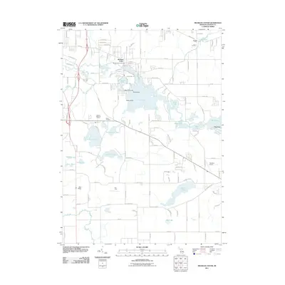
1971 Map of Michigan Center
USGS Topo · Published 1973About this map
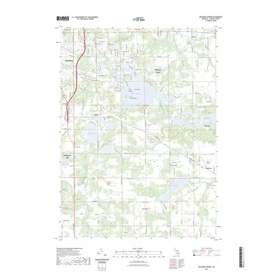
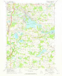
Michigan Center sits at the heart of this glacial landscape, where the Grand River feeds into a complex chain of water bodies including Center Lake and Round Lake. The settlement pattern in the early 1970s shows a mix of suburban growth and established agricultural tracts, with the Penn Central rail line cutting across the northern half of the quadrangle. Significant local landmarks like Roseland Memorial Gardens Cemetery and St Aidans Ch serve the growing population, while the southern reaches remain more open, defined by the prominent Blue Ridge terrain and numerous smaller lakes like Ackerson Lake and Stony Lake. Insight into the era's recreation is found at the YMCA Camp and Lake Land Hills Golf Club, illustrating the post-war transition of this Jackson County area into a residential and recreational hub for the nearby city of Jackson.
Find a feature on this map
73 named features on this map. Tap any name to fly to it.
Don’t see what you’re looking for? This feature index may not catch every label — zoom into the map to look around manually.
Map Details
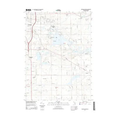
Editions of this 1971 Michigan Center Map
This is the sole edition of this map. No revisions or reprints were ever made.
Historical Maps of Jackson Through Time
6 maps found